
Planet Data Is Here!
The University of Arizona now has a campus-wide license with Planet Labs PBC, giving faculty, staff, students and designated campus colleagues access to a near daily stream of Earth-observation satellite data.
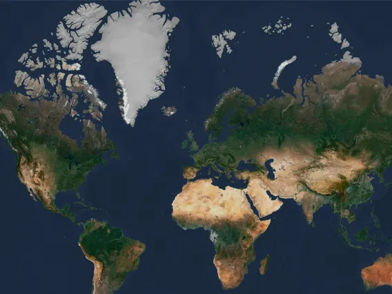
Planet operates a fleet of more than 200 imaging satellites, capturing over 30 terabytes of data per day. Users with a NetID can access this data to combine geospatial datasets, build new models, and obtain new insights in their research and high-impact science.
Sign up to access Planet data.
Register for the student Research Data Challenge!
Watch the Planet Labs Overview
How you can use Planet data in your research
Users can access Planet data to combine geospatial data sets, build new models, and obtain new insights in their research and science. Educational and research use of data can include:
- Programming for Geoscience using Python
- Geographic Information Systems applications
- Planet data is capable of being used within various GIS applications
- Artificial intelligence in conjunction with computer visualization
- Google Earth Engine
- Planet has an API that allows for advanced processing in the cloud by feeding the data into Google Earth Engine
- Creating Planet Stories with data
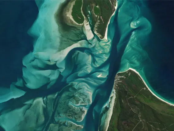
Planet data: PlanetScope and SkySat

PlanetScope Imagery
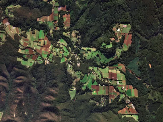
- PlanetScope is a multispectral sensor onboard Planet's Dove satellite constellation of approximately 130 satellites. This constellation collectively is able to image the entire Earth's landmass every day since 2017 (a daily collection capacity of 200 million km²/day). PlanetScope imagery contain approximately 3 meter spatial resolution and are collected in 8 spectral bands.
- PlanetScope data can be downloaded by individual scenes or in Basemaps (Planet's mosaiced products.) Monthly Global Basemap products are generated as "visual" (RGB) datasets and limited availability 4-band surface reflectance basemap products.
- Image Source: PlanetScope

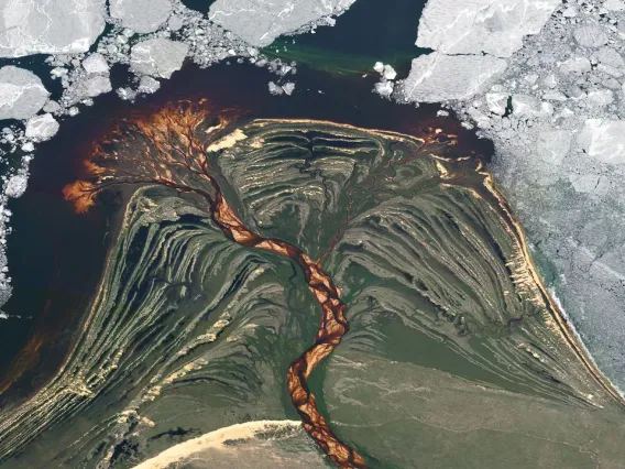
SkySat Archive
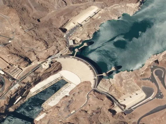
- SkySat is Planet's high resolution satellite constellation that captures targeted images in 5 spectral bands. SkySat imagery also contains a much higher spatial resolution of .5 - .7 m per pixel.
- As part of our campus license, you can search the SkySat archive older than 6 months or request to capture high resolution imagery over your study area. Researchers should contact Angela Cruze or Tyson Swetnam for tasking data. This data is restricted to faculty researchers only.
- Image Source: SkySat
FAQs
- Access to a Planet Labs account and data is available to faculty, staff, designated campus colleagues, and students with an active University of Arizona NetID and email.
- Student applicants must have a faculty member or research staff member as a sponsor. Exceptions are students who enroll in the Data Challenge. These students will be given access to student-level data that is overseen by the Research Data Challenge sponsors.
- Planet Labs data users do not have to renew their seat and use of the data. However, there are a limited number of Planet Labs user seats available to the campus and a semester review will occur to ensure continuous use.
- Because there are limited user seats to access the data, we ask that individual users (faculty and students) and labs contact UArizona Planet Labs admins when they are done with their research project and can relinquish their seat use.
- For researchers (student or faculty) who complete a project but want to maintain access to the data, we ask that they contact the UArizona Planet Labs admins to indicate they have completed their project, that they would like to maintain access, and will be asked to provide a future use research synopsis.
- We want to make access to the use of Planet Labs data to all researchers, including those within a lab group. As space permits, we will allow labs to designate out user access to all lab group members.
- Should seat access become limited, research groups or labs may be asked to designate one researcher to hold the lab account access.
- All lab members that need access to the data must have an active UArizona NetID and email, and their names and information will be required. As well as the plan for lab student use.
- Planet Labs data is not public use data and may not be used for any social media promotion, apps, or non-academic related or commercial use publications., unless demonstrating current research. The use of the raw data is restricted to research only.
- Publication of images may require additional permission, and researchers should check the publication documents with Planet Labs or contact Angela Cruze, ICDI program manager.
- See Planet Labs Terms of Service for additional information.
- A UArizona Planet Labs data Slack channel has been created to discuss all things Planet Labs data. If you would like to be added to the channel, please email Angela Cruze, ICDI program manager.
For journal articles, use the following citation:
- Planet Team (2017). Planet Application Program Interface: In Space for Life on Earth. San Francisco, CA https://api.planet.com/
For figure captions, use:
- “Image Ⓒ[year of capture], Planet Labs PBC.”
- CyVerse can support your storage and use of Planet Labs data. Sign up for a CyVerse account.
- For Research Data Challenge Students, select the Data Challenge as your user group.
- Planet Lab Data use support will be available on Monday afternoons for students and faculty.
- Please contact Carlos Lizzaraga at to schedule a data use appointment. Zoom group use lessons are available.
- For Research Data Challenge participants, please contact Angela Cruze for general research support.
- Access ArcGIS Pro from the website or contact Andy Honaman for programs that may work best with Planet Data and how to access.
- UArizona students, faculty, and staff can utilize VCAT (Virtual Computer Access Technology) to access ArcGIS, as well as alternate options for MAC users here.
"Education and Research Rights" means the right to: (i) use, access, and view Content through the Platform during the Term; (ii) reproduce, store, display, and print Content, and create Derivative Products in perpetuity; and (iii) publish articles related to or based upon the Content in perpetuity; all for non-commercial purposes, and solely in academic and research journals. Licensee agre es that all such publications must include an attribution that clearly and conspicuously identifies “Planet Labs PBC” as the source of the Content on which the publication was based.
Terms of use agreement.
The license is administered through UArizona’s Institute for Computation & Data-Enabled Insight.
Planet is a leading provider of global, daily satellite imagery and geospatial solutions. Founded in 2010 by three NASA scientists, Planet designs, builds, and operates the largest Earth observation fleet of imaging satellites, capturing over 30 TB of data per day. The company is driven by a mission to image the world every day, and make change visible, accessible, and actionable. Planet has multiple data access pathways for university researchers and students to utilize their high spatial and temporal resolution imagery for high impact science. From economists to ecologists, experts are combining geospatial datasets, building new models, and deriving new insights with access to Planet data.
The images from Planet have a much higher resolution at three to five meters and the increased resolution allows for more advanced research and learning opportunities.
Planet data tutorials

Getting Started With Planet University
Consult this quick start guide to learn about Planet University, get started using Planet data, and gain access to Planet's help and support resources.
Intro to Planet
This course introduces Planet's satellites and platforms to new Planet Data users.
Intro to PlanetScope
The course is an introduction to using PlanetScope data and the ways to get the most out of the data.
Intro to Remote Sensing
This is an introduction course to the field of remote sensing, including the methods and science behind collecting remotely sensed data.
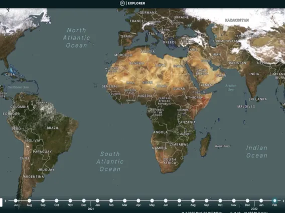
Intro to Planet Explorer
This course introduces Planet Explorer, Planet's primary web-tool used to view, download and analyze Planet imagery.
Intro to Planet Basemaps
This course is an introduction and overview for using Planet Basemaps, focusing on the Basemap Web viewer tool.
Intro to Planet Stories
This course is an introduction and overview for using Planet Stories.
Intro to SkySat
This course will introduce the SkySat product and provides an opportunity to learn more about the data, terminology used, tools to support data, and settings that allow you to get the most out of the data.
Discover how UArizona researchers use Planet data
Have new published findings using Planet data? Let us know!
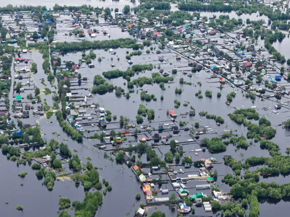
Flooding & Monsoon
Flood mapping of monsoon events over Pima County
This project, in collaboration with the Pima County Government, assesses the utility of satellite imagery to detect floods in the desert, in particular the advantage of high frequency PlanetScope commercial data.
Flood Mapping
Leveraging convolutional neural networks for semantic segmentation of global floods with PlanetScope imagery
Researchers used Planetscope and deep learning to enhance global flood mapping.